
Whether an off-road vehicle can get over a rock often depends on which way it is facing. A boulder that is impossible to climb head-on may be easy to cross at an angle, yet most traversability maps ignore this and give each patch of ground a single safe-or-unsafe score.
Feeding the approach angle into a model as an extra input is one option, but it demands far more varied training data, and the planner has to query the network again for every heading it considers, which is slow.
SPARTA instead takes a dense point cloud of the terrain and predicts, for each location, a smooth function over every approach angle rather than a single number. The function is built from Fourier basis functions, whose smoothness and periodicity help it generalize and suit angles, which wrap around. Because the output is a function, one network pass covers every heading, and the planner can check any angle at almost no extra cost.
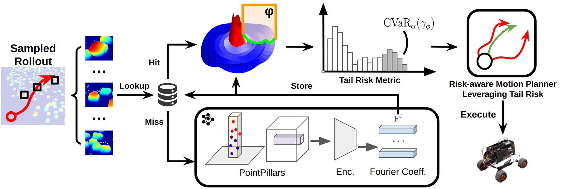
In a high-fidelity simulator, SPARTA crossed a 40 m boulder field 91% of the time, compared with 73% for the baseline. Hardware experiments show that the approach carries over to real terrain.